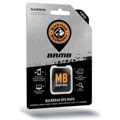
Backroad Mapbook Manitoba GPS Maps
- Product Number: 1141 - 3360674
Located in the Canada’s geographic center, Manitoba boasts a vast and wild landscape that is brimming with outdoor recreation opportunities. Over half of the province’s population lives in the capital city of Winnipeg, leaving the rest of Manitoba wide open for outdoor explorers. From the rolling prairie to the sprawling pine forest, ancient Canadian shield rock and Arctic tundra, there is much to discover here, whether on foot, by car, bicycle, ATV, snowmobile or kayak. And don’t forget the approximately 100,000 lakes that offer anglers some of the most exciting fishing action in the country, nor the abundant hunting ranges for everything from Canada goose to white-tailed deer.
Features:
- Garmin-licensed & compatible with Garmin GPS™, Basecamp™, MapSource™ and RoadTrip™.
- Includes all standard Garmin features such as Find tool, city navigation and more.
- Preloaded 1:20,000 / 1:50,000 base scale seamless topographic maps.
- Provides 3D views and the highest level of map detail available on select Garmin GPS units and Basecamp™.
- Compatible with the latest Garmin 66i unit and inReach technology.
- The most complete Resource, Industry, and Logging road coverage available for Manitoba.
- Extensive routable road network including City, Resource, and Industry Roads.
- Highlights tens of thousands of kilometres of trail systems, including defined ATV, Paddling, Snowmobile, Long distance & Multi-use trails.
- Features smart background & Searchable Game Hunting Areas for hunters.
- Includes National, Provincial, Regional, and other Parks & Campsites.
- Extras like Lake & Stream Fishing information with boat launches, paddling access points, bathymetric depths, and more.
- Searchable BRMB descriptions and activity information for fishing, paddling, parks, trails and more.
- Thousands of Searchable cities, Geographic Land, and Water features.
- Includes Oil and Gas wellsites, cutlines, pipelines and more.
- Features Address and Land Survey Sections and Quarter Section grid searching to aid navigation.
- Industry leading cartographic contours and shaded relief for all of Manitoba.
*Screenshots may vary dependent on your GPS unit.
Specifications:
- Map Scale: 1:20,000 TOPO maps; 1:50,000 TOPO maps (north of 53')
- Regional Cities/Parks: Beausejour, Brandon, Emerson, Gimli, Portage La Prairie, Riding Mountain Provincial Park, Selkirk, The Pas, Thompson, Whiteshell Provincial Park, Winnipeg


