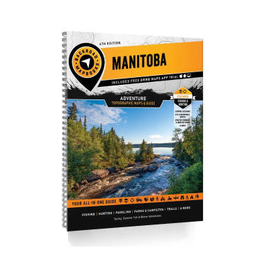
Backroad Mapbook Manitoba 4th Edition
- Product Number: 657 - 391009
Manitoba is home to vast stretches of unspoiled wilderness interspersed with quaint rural communities that serve as a jumping-off point for outdoor recreational pursuits. Located in Canada’s geographic centre, over half the province’s population lives in the capital city of Winnipeg. This leaves the rest of the province-wide open for exploring. To the south, the landscape is a diverse mix of tall grass prairie, pine forest and even desert-like sand dunes. Moving north leads into the majestic rock of the Canadian Shield, and further north still, a strip of Arctic tundra along Hudson Bay, home to the polar bear capital of Canada, the community of Churchill. While Lake Winnipeg garners a huge chunk of real estate, lakes of all sizes and shapes dot this prairie landscape, creating an incredible abundance of fishing opportunities.
Containing extensive updates and upgrades, the 4th Edition of our Manitoba Backroad Mapbook will help you navigate this unique part of Canada. These include the addition of provincial Crown land areas on the maps, noting fish species for many lakes and the bigger river systems, countless road and trail updates and hundreds of new recreational Points of Interest. The Adventures section has also undergone a thorough review with notable additions to the Backroads, Hunting, Paddling, Snowmobiling and Winter sections, plus new additions to our fish stocking and trail charts.
What's new for the 4th Edition Manitoba Backroad Mapbook:
• Updated Road and Trail Coverage
• Updated Backroad Attractions, including diving sites, waterfalls, grain elevators and more
• New Overland and ATV Routes
• New Backcountry Huts Bonus Section
• New Beaches Bonus Section
• Updated canoe routes
• Countless new hiking, biking, ski and snowshoe routes
• Additional Fishing Lake stocking information and charts
• Detailed information on each Hunting GHA
• Updated and expanded Trail Charts
Mapbook Features:
• Private Land
• Labeled fish species for fishing lakes
• National, Provincial and Regional Parks, Private Campgrounds and First Nation areas
• Detailed resource, industry, logging and ice road coverage for the province
• Stocking charts for Manitoba’s stocked fish species
• GHA Hunting boundaries clearly delineated
• Easy to use Index and Navigation Information
Map Scale & Area:
Map Scale: 88 Maps - 60 Maps at 1:250,000 scale, 21 Maps at 1:500,000 scale and 7 Maps at 1:1,000,000 scale
This mapbook includes Altona, Beausejour, Brandon, Carberry, Carman, Churchill, Dauphin, Flin Flon, Gillam, Grand Rapids, Lynn Lake, Minnedosa, Morder, Morris, Neepawa, Niverville, Norway House, Portage la Prairie, Russell, Selkirk, Ste. Anne, Steinbach, Stonewell, Swan River, The Pas, Thompson, Virden, Winkler, Winnipeg & more.
Features Included:
Highways, Logging Roads, Land & Water Features, Parks, Adventure Points of Interest, Campgrounds, Hiking Trails, Motorized Trails, Paddling Routes, Hunting & Fishing Areas, Winter Recreation and more.
The printed version of the mapbook comes in the convenient 21.5 x 28 cm (8.5 x 11 inch) mapbook format with a heavy-duty spiral-bound cover. The 224 page book includes 88 maps starting at 1:250,000 scale, along with 13 Outdoor Adventure sections, a Service Provider Directory, Map and Adventure Index, Trip Planning tools and more. With over 140,000 kilometres of roads to view, including the most complete logging and industrial road coverage available, the books are ideal for navigating on road trips and planning from home.