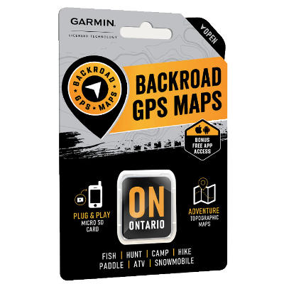


Backroad Mapbook Ontario GPS Maps
Loading...
- Product Number: 4037 - 8401116
Item is out of stock but can be ordered in. Once you place your order we will confirm a delivery timeline with you.
From the beaches and stunning parks of the Great Lakes to the endless forest and ancient Canadian Shield rock of the interior and the vast, unbroken wilderness of the north, Ontario has a dazzling range of options for outdoor explorers. Whether you are paddling along the shores of Manitoulin Island, spending the night under the stars in Algonquin Provincial Park or stalking a moose through the province’s vast northern backcountry, there is no shortage of memories to be made in Ontario’s great outdoors, and our Ontario GPS Maps are your ultimate guide to making the most out of your experience.
Features:
- Over 660,000 km of our backroads network combined into one map, including close to 310,000 km of routable roads and 34,000+ km of backroad additions in Version 2019.
- Extensive routable road network including City, Resource, and Industry Roads.
- Highlights tens of thousands of kilometres of trail systems, including defined ATV, Paddling, Snowmobile, Long distance & Multi-Use trails.
- Features smart background & Searchable Wildlife Management Zones (WMZs) for hunters.
- Includes National, Provincial, Regional, and other Parks & Campsites.
- Extras like Lake & Stream Fishing information with boat launches, paddling access points, bathymetric depths, and more.
- Clearly defined Crown land for hunters, anglers and campers.
- Searchable BRMB descriptions and activity information for fishing, paddling, parks, trails and more.
- Thousands of Searchable cities, Geographic Land, and Water features.
- Includes Lake Bathymetry depth contours for close to 1,500 lakes.
- Features Address searching to aid navigation.
- Industry leading cartographic contours and shaded relief for all of Ontario and southern Quebec.
- Garmin-licensed & compatible with Garmin GPS™, Basecamp™, MapSource™ and RoadTrip™.
Specifications:
- Compatible with the latest Garmin 66i unit and inReach technology.
- Preloaded 1:20,000 / 1:50,000 base scale seamless topographic maps.
- Includes all standard Garmin features such as Find tool, city navigation and more.
- Provides 3D views and the highest level of map detail available on select Garmin GPS units and Basecamp™.
- The most complete Resource, Industry, and Logging road coverage available for Ontario.
- Close to 310,000 kilometres of Routable Roads including city roads, rural roads, and 3 levels of Logging Roads (Industrial, Resource and Winter Access Roads)
- Over 350,000 kilometres of non-routable roads including Old Logging Roads, Unclassified Roads, Alleyways, Leased and Private Roads and more
- 17,200+ kilometres of Trails for hikers, mountain bikers, horseback riders, cross-country skiers, plus over 3,800 kilometres of the Trans Canada Trail
- 35,000+ kilometres of Snowmobile Trails
- 13,500+ kilometres of ATV-QUAD Trails
- 22,800+ kilometres of Paddling Routes