Winnipeg Assiniboine River Canoe Route Map and Guide
Assiniboine River Canoe Route Map & Guide
All trip information is accurate to our knowledge at the time of posting, and provided for informational purposes only. Map additions or suggestions can be directed to buffy@wildernesssupply.ca. All images and descriptions are the property of Wilderness Supply.
A NOTE ON PADDLING RIVERS:
The Assiniboine River is quick moving and cold in the spring and early summer. We do not recommend paddling at this time of year unless you have previous river experience. In the late summer and fall the rivers are usually quite safe to paddle - but always keep your distance from bridge pillars, small islands and other in-water hazards, as these create fast-moving currents that can take inexperienced paddlers by surprise.
Trip Details
Type: Canoe or Kayak
Approximate Distance: 6km (from Omand's Creek), 8.5km (from Bruce Park) or 17km (from Coleridge Park)
Number of Portages: 0
Recommended Time:
1 hr (from Omand's Creek), 1.25 hrs (from Bruce Park) or 2 hrs (from Coleridge Park)
Fees/Permits required: None
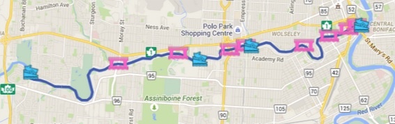
Click through for full interactive google map
Planning
This route is perfect for a day or evening paddle in Winnipeg, especially since it ends at the forks where you can secure your boat and stop for a meal or a drink. Since it is a one-way route, you will have to arrange to collect your vehicle at the end of the trip. The three easiest options are:
- Drive your car to your put-in, and take all straps and foams with you in the canoe. Arrange for someone to pick you up from the forks. If possible, load the canoe onto their vehicle and drive back to your car. If not, secure the canoe at the forks (a cable lock around a tree and through the canoe thwart works well) and get a ride to your vehicle. Drive back to the forks to collect your canoe.
- If your paddling crew has two cars available to them, drive both cars to the forks and leave one there (parking restrictions and fees vary by lot). Drive the second car with all people and the canoe to the put-in location. Leave the second car at the put-in, and bring all foams and straps with you in the canoe. When you get to the forks, load the canoe onto the first car and drive back to where the second car was parked.
- If you only have one vehicle, drive to your put-in and leave all foams and straps in the vehicle. After paddling secure your canoe at the forks and walk up to Portage Ave. Catch the westbound 11 or 21 bus - both run along portage near all three possible put-ins. Get off the bus and pick up your car, then drive back to the forks to collect your canoe.
This route can be paddled with most types of canoes and kayaks, which are available to rent from Wilderness Supply. At certain times of year the river may be shallow at some points - be cautious if using a kevlar boat that you do not scrape or drag the bottom.
The Route(s)
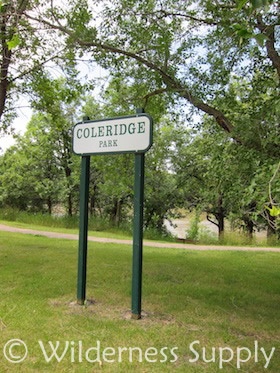
From Coleridge Park
Head west on Portage Avenue, and turn south down Bedson St (the second-last set of traffic lights before the Perimeter Hwy). Turn right down Coleridge Park Dr and park your car near the park. At the north end of the park there is a set of concrete steps leading down to a sandy put-in.
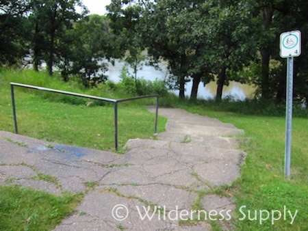
Coleridge Park Put-in
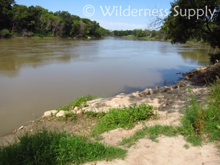
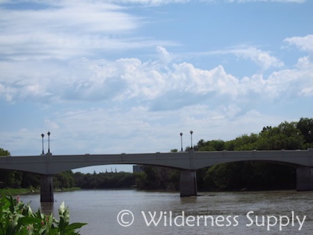
Paddle southeast, with the flow of the river. The river will take you past the St Charles golf club on the left, and under the Moray bridge and Assiniboine Park footbridge before continuing past Bruce Park.
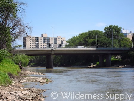
The Moray Bridge
Assiniboine Park Footbridge
From Bruce Park
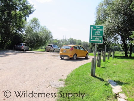
Drive west on Portage and turn south on Ferry Road. Drive to the end of the street, where you will find ample parking in the Bruce Park and Bourkevale Community Centre lot. Across the grass there is a rocky put-in that is also a popular spot for fishing. The park is an off-leash dog park, so you may meet some curious pups while unloading!
Bruce Park Put-in
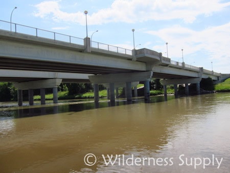
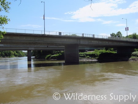
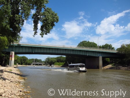
Paddle east, with the flow of the river. You will pass under the route 90 bridge and a rail bridge before continuing past Omand's creek.

Route 90 bridge
From Omand's Creek
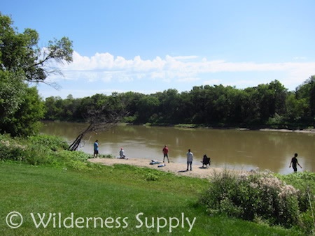
Drive west on Portage and turn south on Raglan Road. Park near Omand Park and cary your canoe down the paved pathway towards the water. Depending on the water level you may have to put in near the creek mouth where the banks are lower. Beware of slippery or muddy rocks, especially while carrying your boat.
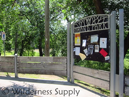
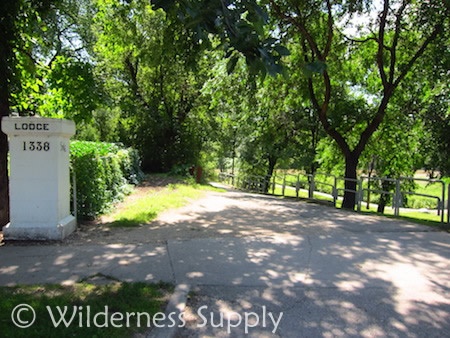
Omand Park Put-in
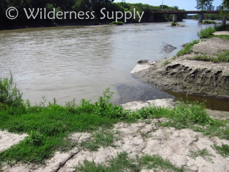
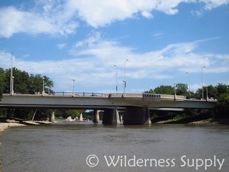
Paddle east, with the flow of the river. You will pass under the Maryland bridge, Osborne bridge, Donald St Bridge, and St Mary's bridge on your way to the Forks Harbour.
Maryland Bridge
Osborne Bridge
Donald Bridge
St Mary's Bridge
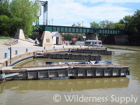
Pull up at the public docks at the forks harbour. If you intend to stay at the forks to eat or drink after your paddle consider bringing a
cable lock so you can take your canoe out of the water and secure it to a tree or fence while out of eyesight.
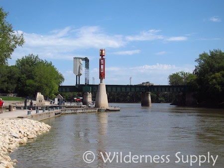
The Forks Harbour
The Forks public docks
Important Notes:
- Always leave a detailed trip plan and estimated time of return with someone at home before embarking on any trip.
- Check all parking signs and restrictions when parking in residential areas. Make sure any valuables are out of sight or taken out of your car before you leave it.
- Always keep your distance from bridge pillars, small islands and other in-water hazards, as these create fast-moving currents that can take inexperienced paddlers by surprise.
- Locations along this route may appear different from the provided photos depending on water levels. Some put-ins may be either easier or harder to reach in high water.
- During high water and early in the season the river may be unsafe to paddle for those without experience. Always confirm the current water conditions before heading out.
- Drowning and hypothermia are real risks even for experienced paddlers. Don't end up on the news - always wear a PFD when on the water, and keep watch for changing weather conditions. Early in the season the river can be fast moving and very cold, and should not be paddled without proper protective gear and experience.
- If you have questions about this or any other trips, please visit your nearest Wilderness Supply store, where our staff will be happy to provide advice and suggestions!
All paddlers undertake trips at their own risk. Canoeing/kayaking is a potentially dangerous activity, and should not be undertaken unless you are medically able and properly trained. Wilderness Supply has no responsibility for any claims, demands, causes of action, damages, or injuries, whether caused by paddler negligence or any other cause on this or any other provided trip routes. Paddlers should assess both the current conditions and their own skill levels at all times during their trip to take the safest course of action possible. Always leave a route plan and expected time of return with a third party before heading out on a trip, and take along a means of making emergency contact if necessary.