Saturday, July 25, 2015 - Blog on a Log
Wild Trip Reports: Experimental Lakes Area Stewart Lake Loop
At Wilderness Supply we encourage our staff to get out and use our gear as much as they can - it's the best way to make sure they know what to recommend to you! Our employees can be found adventuring all over the world. Today we bring you a Wild Trip Report from close to home: The ELA, or Experimental Lakes Area.
These posts will be a chance to feature some of our staff's adventures (and misadventures, no doubt!) wherever they may lead. Whether on the road, trail, or water, we love sharing our experiences with you, and hope you'll be able to use them for your own inspiration and planning...or perhaps just a little vicarious living!
The ELA Stewart Lake Loop
Tripper: Heather Z
Location: Ontario
Type: Canoe Trip
Date: June 21 - 23, 2015
I grew up canoeing, and some of my favourite memories are from the family canoe trips. When Craig and I started dating, I was happy to find someone who likes camping, but disappointed that he did not like canoeing. However, lucky for me, Craig is a big fan of the outdoor articles written Bartley Kvies, of the Winnipeg Free Press, and he recently suggested we try some of the paddling routes suggested from his articles. We decided to do a short trip, since this would be Craig's first time out in a canoe for longer than a few minutes as a Boy Scout, and began looking at some of the routes Bartley suggests in the Experimental Lakes area.
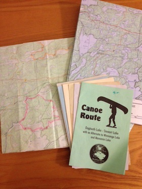
Finding information about canoeing in the ELA was and is challenging. Up until the week before our departure date, all we had to go on was the newspaper article and our topographical maps. Thankfully when I mentioned to a couple of our long-term customers at Wilderness Supply that we were finally going on our first canoe trip I discovered that they had paddled in the same area many times, and they generously offered to sit down with us and share their maps. I also had the good fortune of listening in when Bartley stopped by the store to draw on another staffer's maps of the same area, which made us we feel much more confident.
Planning the Route
On the morning of our trip, we managed to get all packed up and on the road ahead of schedule. It is about a three hour drive out to the Experimental Lakes Area. We were warned that the turn off comes up quick, and is easy to miss, but even with that knowledge, we still blew past it. A short way down the highway we managed to turn around, and after our little detour we finally made it to our destination. We were told to drop our gear off at the put-in before parking the car, but Craig forgot, so we ended up carrying everything back up the road. Thankfully we had one of the lightweight Kevlar rental canoes. At the same time, a rather large group was coming out of the put in, so it would have been a bit crowded if we had left our gear there first.
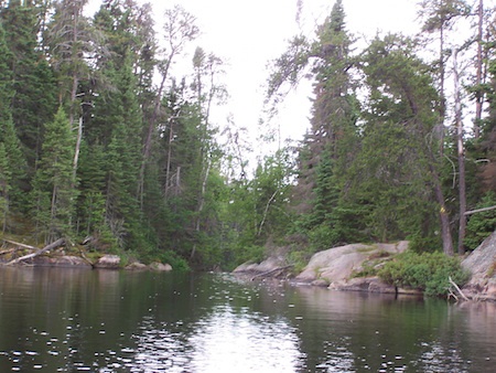
Once we were in the water we headed up the channel to Railway Bay, which was quite rocky with unusually low water levels. Craig's sunglasses aren't polarized, so even though he was in the bow, he couldn't see the rocks as they were coming up and kept asking where when I warned him to get ready to push off. On calm days, having me in the stern was all right, but later in the trip, when the wind was our constant companion, the weight different between us combined with the conditions made for some challenging moments controlling the canoe.
As we exited the little channel into Railway Bay, Craig promptly directed us to paddle into the wrong bay. Once I realized we were already lost in less than an hour of paddling, I became the navigator. We made our way back out and around that first little bay and found the first portage easily. Craig kept some binoculars with him up front so he was able to start scanning the area for the blazes that indicate where the portage is located, since we did not know if it would be to the left or right of the little set of falls.
First portage - Lower Stewart Lake to Geejoy Lake
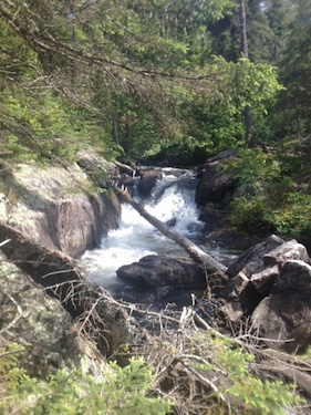
The falls at the first portage
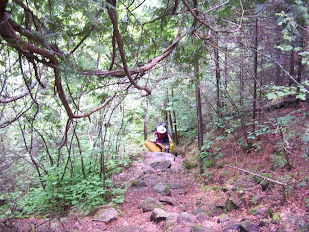
On the first portage, we foolishly decided to portage the canoe first, and ended up taking the high ground, which was more work. On the way back we discovered the path split and had an easier, although muddier, stretch of ground. Those trails are lined with wild strawberry plants, and native orchids. The strawberry plants were in full bloom, so someone going through in late July or early August will probably be able to pick some tasty treats. We rested a bit after this portage, and Craig joked that we could just take the motor boat that was at the end of it, and not bother carrying the canoe anymore.
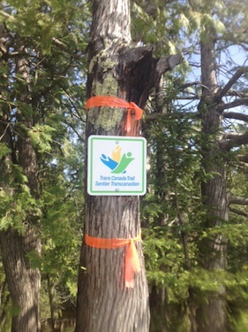
After this portage, the paddle to the next one is quite short. We were warned that it can be quite windy getting out of the channel into the lake, which it was, but once you round that corner, it was not so bad. Our friends told us to look for a cabin at the next portage, and once we got out of the channel, the red roof in all the green tree tops pointed the way. We didn't get a photo of this portage; the cabin owners have signs up directing you to where they want you to land, which is right next to the rapids, and the water was moving too fast for either of us to comfortably take one. It looks as though you are landing in their front yard, but the Trans-Canada Trail sign is there to mark the way.
This time, we decided to take our gear first, to scout the trail before having a canoe obstruct our field of vision. Once we got down the first little hill, it looked like we were at the next put in. So we went back for the canoe, loaded up and were congratulating ourselves on a fast portage....and then we noticed all the rocks...and what looked like a beaver dam...and realized that we were too eager. So back we went, and discovered that the full portage is much longer.
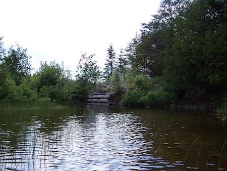
After this we started to make our way to the first campsite. A few people had told us to keep next to the main land, and paddle with the island to our left, but with the water being so low, and what looked like a downed tree across the only passable part of that section, we decided to go the long way around the island to the campsite. There are two options for putting-in here. The first one is a nice level rock area on the east side of the island. If you put-in there, take the path to the left and it will lead you to the camp site. If you choose to keep going around to the south put-in just below the campsite it is a little more rocky, and the bank is a bit steep to climb up, but not difficult.
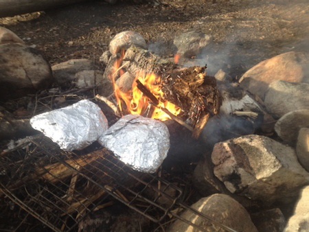
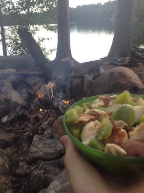
By this time, it was around 7pm and we were hungry and ready for a nice rest. We got the tent up in no time, our gear in its proper place for the duration of our stay, and started dinner cooking cooking over the fire. Craig scouted a tree for our food bag and I walked around taking photos of Lady Slippers, another native orchid that was in full bloom. Though the campsite was nice you could tell it is used a lot, as people have already started to leave garbage behind. Someone clearly plans on coming back quite often, as they have left some kitchen stuff there. Since we had planned on having tin-foil dinners, but did not bring any tongs to use in the fire, I decided to take advantage of the grill with a handle to cook our dinner over the fire with.
After dinner, we enjoyed the fire a bit longer and hung the food bag, which required me going back for a paddle to help push it up high. On my way back, I stepped funny over a fallen log and managed to twist my ankle, which was not fun. No matter what, we were two portages away from help, so I was hoping it would turn out to be my typical twisting of an ankle, which would hurt like crazy for a few hours, and then be fine. I used the paddle like a crutch to get back to camp without stressing my ankle too much, and took a look to see if there were any signs of it being seriously injured. Since it just looked swollen, I decided to wait and see.
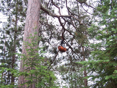
Our Bear Bag
We decided to freshen up a bit in the lake before bed. The water was nice and cold and I kept my ankle in there a bit longer than I normally would have since we do not have an ice pack in our first-aid kit. That seemed to help keep the swelling down. After wrapping it up in a tensor and taking a pain-killer, we climbed into our sleeping bags. I woke up to the thunder in the distance, and braved the army of mosquitos to close the tent up before we got wet. Craig of course, slept right through it all, and didn't notice the army of mosquitos that followed me back into the tent.
In the morning it cleared up again long enough for us to pack everything up, and make breakfast, but started raining again as we were paddling to the next portage. This portage was easy to find, pretty much just around the corner from the big rock face. It had stopped raining long enough for us to get most of the gear to the other end. We didn't waste any time resting here, even though it is a bit of a long portage compared to the two from the day before. It started raining pretty hard after we were a good way out from land and we were worried that we would start to get thunder and lightening before we found the next campsite. We were trying to figure out which island we were heading for when we finished rounding a corner of the peninsula when a bright yellow canoe came into view. A short while later we were greeted by Sadie, a loud, but friendly dog, and her human, Dan. The first words out of his mouth after shushing Sadie were, “Did you rent that canoe from Wilderness Supply?” After I told him I worked there, he happily informed me that he shopped with us. He told us this was the island we were looking for and welcomed us to join him while he waited for the rain to let up enough to pack up his gear.
We spent a pleasant afternoon chatting with him, and playing with the dog. He told us to pull out our maps so he could share some more campsites and portages with us, and shared his experiences paddling in the ELA. When the rain finally let up, he tore his tent down, and we set up in the exact same spot since the ground was still dry, and he and the dog jumped in their canoe and headed back to Winnipeg. We were a bit disappointed that the travel time this day was so short, only about 2 hours. However even though we spent so little time paddling, since it had rained the whole day, we weren't sad to have spent most of that under some tarps staying as dry as possible. There were definitely a few times I was cold enough to wish I had brought some mitts.
The next morning we managed to get everything all packed up before the rain hit again. This day was definitely our worst day on the water. It was very windy, which make steering difficult, and me sound less than pleasant as I tried to keep us on course. My navigating skills were also lacking and we over shot the bay with the portage in it. The plus side on getting lost is that I can confidentially tell you that if you come to the bay with the white rocks blocking the entrance on one side, you went one bay too far! We finally found the portage, which is further back than normal, so unmarked, by noticing four motor boats on the left hand side in a marshy area. Mr. Resident Beaver has also added some landscaping here, so expect a wet, muddy and very slippery portage.
White rocks - you've gone too far!
This particular portage has garnered some not-so-inspiring nicknames. The Devil's Staircase, and the Big Agony were the two we were told, and I am sure there are more out there. You can approach it from either direction, but most people who had told us about it (some in the store as well as my friends) all said they felt it was safer to go from Winnage Lake into Upper Stewart, which made you climb it with all your gear, instead of having to pick your way down fully loaded. And I definitely agree with them. This one portage made us regret our choice of camping with our luxury sleeping pads and bigger tent, instead of our light-weight hiking gear.
Trudging up the Devil's Staircase
A few people had suggested we bring our gear up the steep part first, dump it and then go back for the canoe, but Craig wanted to just get it over with so we pushed on. His boots were still slippery from the first part, and probably less than 20 yards from the end of the portage, he slipped on the rock going down and fell quite hard. I was walking slower behind him because of my ankle, so I had to remind myself not to run when I heard him yell in pain. Besides the fact that my ankle was still sore, hurrying in that kind of situation is putting yourself at risk as well because it is so easy to overlook hazards if you let yourself panic. I was grateful at this time that we had a Spot device with us if we needed to call for help, but fervently hoping that we wouldn't need to. Thankfully he was not seriously hurt, and we managed to limp to the end of the portage. Once Craig felt well enough, we went back and managed to get the canoe up and over without any more accidents.
The wind was still blowing against us as we fought our way across that bay to the shoreline we needed to follow. Even following it, we had a hard time finding the creek that runs into Railway Bay. We paddled into the correct bay the first time, but it looked like a dead end, so we started working our way back out and further north. I was second guessing my nav skills at this time and had difficulty controlling the pitch of my voice, so I am sure Craig was wondering why exactly we were together by this point in the trip.
Before we got too far away, we heard a motor boat behind us, and when we turned around, we saw one coming out of the original bay we had tried. We flagged that guy down and asked him where he came out of, and after he assured us the passage was there, we turned around and fought our way back against the wind to the bay. Unless you get right up to the end, you will not see the teeny, tiny passageway. I am honestly amazed that guy got his motor boat through there, because it is rocky, and shallow, and not very wide at all. Afterwards, we found out that that was the part of the road that another resident beaver had washed out with his handiwork a few years back, which was why it looks the way it does.
Hidden passage
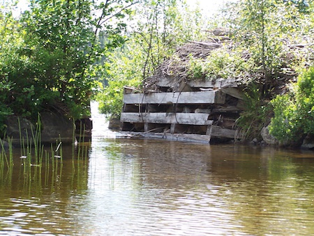
Hidden passage revealed!
There is a thin peninsula you have to stay to the south of as you cross Railway Bay, but without that wind pushing us to the south, it looked like it would have been easy to get on the wrong side of that. Once we managed to get across that bay, we were back at the creek where we had started. Neither one of us was too sad to be loading up though. This day had been our most challenging on the water, and we were tired.
We stopped in Kenora for dinner on the way, and then after dropping the canoe off at work we finally got home and all unpacked by midnight. Both of us were wishing we had an extra day off work the next morning, but other than being a little tired and sore, we survived our first canoe trip together. Craig is already planning our next adventure, by kayak this time, from another one of Bartley Kvies articles.
Some things I learned from this trip:
- Take advantage of the knowledge on anyone who has paddled/hiked/camped in the same area before.
- Pack light!!! Except for our tent and sleeping pads, we were light, but that last portage was not awesome and I will give up the luxury sleeping pad for my light-weight sleeping pad if I have to carry it any farther than from the car to the tent.
- Finding the right balance of packing enough food just in case you are stuck out an extra day or two, and not packing enough food just in case you are stuck out for an extra day or two, is not easy. We fuelled up on our high-energy snacks so much during the day, that by dinner time, we ate half of what we had thought we would. Even though we were happy to lug around the extra food for the “just in case situation”, we could have left a bit behind.
- Gravity filters are your friend. We were using the MiniWorks pump, which was great, but after pumping 4-6 liters in less than an hour each night so we could make dinner, wash dishes, and fill our water bottles, wash up, etc, we were wishing for a gravity filter for the campsite.
- Make a copy of the map, with the route drawn on it, for the other person in the canoe to have as well. Two sets of eyes are better than one, and passing the map back and forth in the wind was not fun. I know that when Craig had the map on the first day, I was wishing for one of my own, so I am sure he felt the same way when I took it from him.
- Waterproof compression sacks are awesome for packing your sleeping bag and spare clothes in.
Some things I learned about this area:
- The turn off for that dirt road is between the Kilometre 116 marker, and Kilometre 122, just past the Gordon Lake Road sign. That sign is on the north side of the highway and the turn off is on the South side of the highway.
- Drop your gear off at the little bridge, then continue up the road some more until you get to the parking lot.
- The first portage is on the right. The second portage is on the left, but right of the cabin. The third portage is on the left. And the fourth portage is on the left. Look for motor boats at each portage. The fishing lodge at Upper Stewart Lake leaves those there for the guests to have easy access to each lake without have to portage. The only portage not marked with a blaze was the fourth one, and I think that was only because the water was so low that you can't access it from the original entry point.
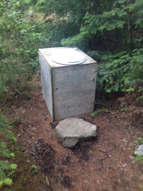
- The second campsite has an awesome “fire place”. Someone also installed (incorrectly) an outhouse here. Whomever installed it clearly did not dig a hole first, vent the box, or plans on moving it when needed and burying the waste, so it is smelly. I would suggest not using it, but will let you decide if you can handle the smell...
- For anyone planning on doing this same trip and wanting a longer time on the water the second day, I would suggest the longer route. That was our original plan, but our friends had never paddled to that portage, so couldn't give us any insight on what to look for. We had decided to play it by ear if we would try it or not, and the rain make that decision for us, so unfortunately I can't give you any information about it either.
- That last portage is a killer. Seriously, take your gear up the staircase, dump it, and go back for the rest. Then move on. You will be so happy to have that behind you.
Gear List
In My Boat
- Grey Owl Sprite Paddles

- Economy Paddle (as spare & apparently crutch...)
- North Water 4 Bailer
- Sealine Seal Pak (held the stuff Craig wanted to keep on his person)
- Sealine Baja 5L Drybag (held the stuff I wanted to keep on my person, like my epi pens, snacks and the Spot Unit)
On My Back & Feet
- Smartwool medium weight hiking socks
- Vasque hiking boots
- Gaiters (on the last portage)
- Light weight, quick dry hiking pants
- Smartwool NTS 195 Long Sleeve Top
- High UV Buff (to block the wind from my ears)
- Outdoor Research Rain Hat
- Sunglasses
- Quick Dry Hiking Undies
- Kokatat Aries PFD
- Fox 40 Pealess Whistle (attached to the zipper on my PFD so it doesn't get lost)
In My Bag
- Extra Smartwool mid weight socks
- Smartwool NTS 150 T-shirt
- Extra Quick Dry Hiking Undies
- Smartwool 250 Weight Bottoms (for sleeping in)
- Smartwool 250 Weight Long Sleeve Top (for sleeping in)
- North Face Dryzzel Rain Jacket
- Rain Pants
- Synthetic 2 Season Sleeping Bag
- Princeton Tec Headlamp
- Spot Unit
- MSR Miniwork Water Filter
- Nalgene 1 L bottles
- Hiking Stove
- MSR Fuel Bottle
- Frying pan
- Pot
- Spatula
- Sea To Summit 10L Folding Bucket
- Campsuds
- Clothesline
- Dish Cloth & Towel
- Quick Dry Pack Towels
- First Aid Kit
- Drybag with Toilet paper
- Trowel
- 4 Person Tent & Foot Print
- Thermarest LuxuryMap Sleeping Pad
- Thermarest Compress Pillow
- Axe
- Matches in a small Sealine Dry Bag
- GoalZero Nomad 7 Solar Panel
- Shewee
- Coghlan's Bug Jackets
- Paracord, Cargo Net, & Carabiner (to hang the food bag with)
- Sealine Map Case with Feist Lake Map (52 F/13) & Dryberry Lake Map (52 F/12)
- Sealine Waterproof 75L Duffle (held the cooking gear, tent, pillows, first aid kit)
- Sealine Baja 20L Drybag (held our food)
- Hiking Bag (held our waterproof compression bags with our sleeping bags and clothing)